


District 2, Perkins County, Nebraska
About
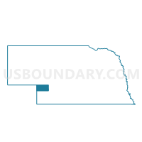
Outline

Summary
| Unique Area Identifier | 613687 |
| Name | District 2 |
| County | Perkins County |
| State | Nebraska |
| Area (square miles) | 247.25 |
| Land Area (square miles) | 246.62 |
| Water Area (square miles) | 0.63 |
| % of Land Area | 99.74 |
| % of Water Area | 0.26 |
| Latitude of the Internal Point | 40.85037290 |
| Longtitude of the Internal Point | -101.70117480 |
Maps


Graphs
Select a template below for downloading or customizing gragh for District 2, Perkins County, Nebraska


Neighbors
Neighoring Voting District (by Name) Neighboring Voting District on the Map
- Brule Precinct, Keith County, NE
- District 1, Perkins County, NE
- District 3, Perkins County, NE
- Imperial Rural Precinct, Chase County, NE
- Logan Precinct, Keith County, NE
- Ogallala Rural Two Precinct, Keith County, NE
Top 10 Neighboring County Subdivision (by Population) Neighboring County Subdivision on the Map
- District 3, Perkins County, NE (1,113)
- District 2, Perkins County, NE (978)
- District 1, Perkins County, NE (879)
- Brule precinct, Keith County, NE (811)
- Rural Ogallala precinct, Keith County, NE (808)
- Imperial Rural precinct, Chase County, NE (616)
- Logan precinct, Keith County, NE (318)
Top 10 Neighboring Place (by Population) Neighboring Place on the Map
Top 10 Neighboring Unified School District (by Population) Neighboring Unified School District on the Map
- Ogallala Public Schools, NE (6,735)
- Chase County Schools, NE (3,225)
- Perkins County Schools, NE (2,818)
- South Platte Public Schools, NE (1,162)
Top 10 Neighboring State Legislative District Upper Chamber (by Population) Neighboring State Legislative District Upper Chamber on the Map
Top 10 Neighboring 111th Congressional District (by Population) Neighboring 111th Congressional District on the Map
Top 10 Neighboring Census Tract (by Population) Neighboring Census Tract on the Map
- Census Tract 9619, Chase County, NE (3,966)
- Census Tract 3, Keith County, NE (3,575)
- Census Tract 9593, Perkins County, NE (2,970)